The 53-kilometre Chilkoot Trail starts in Dyea, Alaska, at sea level and in full rain forest. There is lush vegetation, dense, fragrant canopy, moss of fairy tale proportions and lots of climbing on steps hammered into the earth by the US Trail Service. It ends at Bennett Lake, British Columbia, the water conduit to the gold fields of Dawson City. This is where it all started in 1898 for the Klondike Gold Rush, as noted by a commemorative plaque at the trailhead.
I first hiked the Chilkoot in 1978 and have continued to walk it most years since. Having it in my own backyard means I’ve been able to spend some time every year, for more than 40 years, in one of the most beautiful places on earth.
What makes the Chilkoot challenging is that each climb over the pass can be very different. It truly is a unique experience each time one walks it. In June 2019, I traversed the slippery, soft snow in full whiteout conditions. In August 2018, we were in water up to our knees through the flood zone of the cresting Taiya River and hot, hot, hot over the top. A lot has changed since then, but a lot has remained the same as well.
The US side of the trail has seen constant upkeep and improvement. In the stone stairs up steep inclines, in the solid steel cable bridges, in the raised boardwalks through the Beaver Ponds and in the newly constructed shelters at the campsites. Instead of the old, higher camp, close to the summit, Sheep Camp is now lower down and boasts a huge open-air shelter that’s able to accommodate 50. There’s also a new (as of 2019) log cabin to warm hikers in bad weather. Two solid wall tent cook shelters also contribute to the infrastructure and there’s also up-to-date solar power at the US warden tents.
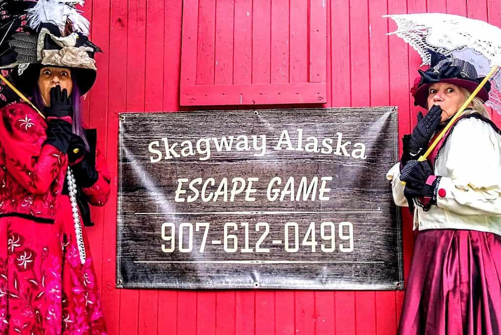
Through the 1980s and into the 90s, we would watch for a high-pressure system and go. Now, one must plan ahead and register with Parks Canada in Whitehorse, or try being one of 10 daily ‘walk on’ hikers at the Skagway Trail Centre. Either way, you pay for your reservation on the Canadian side. The US side has always been free. The new limit is 50 total hikers a day. The US outhouses have always supplied toilet paper, while you must bring your own on the Canadian side.
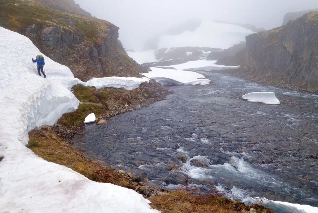
The approach to the Scales/Golden Stairway remains a challenge. A dawn start out of Sheep Camp takes one through dense, dark forested paths that steadily climb. Eventually, one breaks through the trees and into the alpine. The view will take your breath away, either for fear of what’s to come, or awe at the wide expanse of rock and the deafening Taiya River. It’s a long climb up to the Scales, which have been described as “one of the most wretched spots on the trail.” There’s a 45-degree climb over the big boulders that make up the Golden Stairs and then you continue through the steep, narrow pass that makes for a final ascent. The path is strewn with remarkable Gold Rush artifacts. It also marks 1,000 M of ascent since Dyea.
The Canadian flag has flown proudly to mark the entry into Canada. Sadly, on my recent June trip, it wasn’t present. Hopefully it will be again. This is the spot where the North-West Mounted Police weighed and scrutinized those coming through. Now there’s a small warming shelter for hikers, a new warden’s cabin and an outhouse with one of the best views in all of Canada.
Sharing a bar of chocolate after reaching the summit is still a near-religious experience. There are still sheep and goats at the top, but you must really look for them.
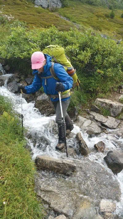
The section beyond the summit has always been an active avalanche zone. Care must be taken while travelling. Don’t stop for picnic lunches. Keep walking. There are many snow fields, rock and sometimes icy side hills with many stream crossings on the descent to brilliant blue Crater Lake.
In the old days, one could dip into any creek and enjoy some of the purest water imaginable. Now a filter or water treatment product is recommended. The US side tells you to spit into the river while brushing your teeth, while the Canadian wardens request that hikers use the grey water pits.
Today, one must camp only in designated areas. In the early days, you could venture off the trail, especially around Happy Camp to find a pristine meadow with soft moss for a pillow and crown sparrows to lull you to a well-deserved sleep. Records are still made for length of time spent sleeping in the tent after the hard summit day. The wind still howls through the valley of Happy Camp.
Metal bear-proof lockers are now provided at each camping spot, replacing the bear poles of days past, and the corresponding evening entertainment of slinging sacks of food over them.
Snow, sleet, hail, thunderstorms and rain can all occur on the trail. It’s still critical to have good rain gear and warm clothing, as hypothermia is a very real threat.
Pack out whatever you pack in. This hasn’t changed.
You must wear a permit tag and carry your passport with you. In the old days, who knew who came into Canada via the Chilkoot Trail?
One now books a train ticket from Bennett out to Fraser, Carcross, or Skagway, but hikers are still shunted into their own segregated rail car. I guess we are all a bit stinky from five days hiking and don’t dare offend the higher-class clientele! The train still goes so slow that one can get off the front and have a picnic lunch and still grab the last car of the White Pass Yukon Route.
The Chilkoot Trail is truly one of the most beautiful places on earth. If you haven’t hiked it in awhile, consider booking it. If you have never hiked it, you will be challenged, delighted, amazed and maybe, like me, want to walk it again year after year after year.